
The Real Cause of Rasuwa Flood: Not a Glacial Lake Outburst, but a Catastrophic Disaster Caused by Falling Rocks and Glaciers – Dr. Dhananjaya Regmi

September 13, Kathmandu.
Experts have reached the preliminary conclusion that the devastating flood that occurred in the Rasuwa region on Wednesday was not caused by a glacial lake outburst, but was the result of an event where a massive rockfall created vibrations that caused a glacier to collapse.
According to Dr. Dhananjaya Regmi, an expert in mountain geomorphology and glaciology, this incident has also exposed serious weaknesses in Nepal’s disaster early warning system. In an interview with Nepal News Bank, Dr. Regmi stated that although the Department of Hydrology and Meteorology focuses on monsoon-related floods and landslides, it has not been able to expand the necessary early warning system for such high-risk events in the Himalayan region.
According to him, the latest study shows that there are currently about 2,070 glacial lakes in Nepal. Among them, 47 glacial lakes are at high risk, including 21 in Nepal, 25 in China, and one in India. He stated that even if the 25 glacial lakes in China and one in India burst, there is a possibility of a direct impact on Nepal.
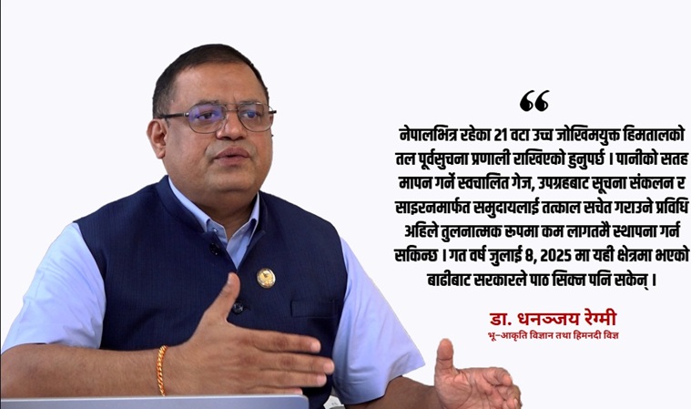
“At least an early warning system should have been installed below the 21 high-risk glacial lakes within Nepal,” he said. According to him, technology for measuring water levels with automatic gauges, collecting information from satellites, and immediately alerting communities via sirens can now be established at a comparatively low cost. He commented that the government failed to learn lessons from the flood that occurred in the same area on July 8, 2025, last year. Despite studies confirming the risk being published after that incident, he stated that the necessary early warning system was not established for a year.
According to Dr. Regmi, who is also a member of the House of Representatives, various initial assumptions were made about this incident, such as a glacial lake outburst, an earthquake of 4.4 magnitude causing the lake to burst, or an avalanche. However, he stated that the latest satellite images and analysis of the events revealed a different picture.
According to him, a massive rockfall occurred in the northern part of Langtang Lirung. The vibrations from this appear to have simultaneously caused another glacier, about three kilometers away, to collapse. “The two events happened almost simultaneously. The energy and vibrations generated by the rockfall also caused another glacier to collapse,” he said.
In this context, although the U.S. Geological Survey (USGS) recorded a tremor of 4.4 magnitude, he stated that there is a strong possibility it was not a tectonic earthquake but a tremor generated by falling rocks from above. He informed that the energy of that event was estimated to be equivalent to approximately 5.2 magnitude.
When both the rock and glacier collapsed, a large volume of ice, rocks, and water mixed together and flowed rapidly towards the Lende Khola, he said. He added that due to friction, the ice immediately melted and turned into water, and as the flood carried trees, rocks, and other materials downstream, its volume further increased.
“Initially, its speed was extremely high. Even after merging into the river, it might have flowed at a speed of approximately 150 to 180 kilometers per hour,” he said.
Advertisement
Since the incident site was about 16 kilometers above the Nepal-China border, he stated that it did not take long for the flood to reach the border. He said that even after hearing the sound, people did not get enough opportunity to escape. “That area is narrow. There are queues of vehicles on the road. Even if one tries to escape, it is not easy to get away,” he said.
Dr. Regmi cited examples such as the 2012 Seti River flood and the Barun Valley incident, which also originated from processes related to large rocks or glaciers, and pointed out the need for the Himalayan region to now prepare for disasters of a different nature than traditional monsoon floods.
According to him, with climate change, rocks in the Himalayan region are becoming unstable, glaciers are weakening, and the risk of such sudden floods is increasing. Therefore, he emphasized that cross-border information exchange, automated monitoring systems in high-risk areas, and mechanisms for immediate community warnings should now be expanded as a priority.
Early Warning System Must Be Strengthened
Dr. Regmi stated that settlements and infrastructure in Nepal’s Himalayan region are at high risk of floods caused by glacial lake outbursts and large landslides in the Himalayan region. He emphasized the need for immediate development of early warning systems, flood inundation modeling, and predetermined routes to safe locations for risk reduction.
According to Regmi, due to Nepal’s geographical conditions, most settlements have developed along riverbanks and streams. While it may not be immediately possible to relocate settlements like Syabrubesi in Rasuwa, he stated that by pre-assessing the risks, structures and routes for people to reach safe places in an emergency can be built.
He stated that a large volume of water and rocky structures in the Himalayan region could collapse or burst at any time, leading to major floods in downstream areas. He added that such risks are not limited to Rasuwagadhi or Kerung but are present in all Himalayan watersheds including Annapurna, Langtang, Imja in Sagarmatha, Barun in Sankhuwasabha, and Tamor.
Regmi mentioned that according to ICIMOD’s study, approximately 25 glacial lakes in the Tibet region could burst, potentially causing floods in Nepal. He stated that some of these incidents have already had an impact on Nepal in the past. He explained that when the Jangjangbo glacial lake burst in 1981, it caused floods in the Arun Valley; when the Jana glacial lake burst in 1985, it affected Trisuli; and when glacial lakes in Tibet burst in 2016, it led to floods in areas including Bhote Koshi.
According to him, Nepal has failed to learn lessons from such incidents since 1981 and has not been able to make coordination with China, weather and hydrometric centers, and early warning systems effective. Instead of merely expecting neighboring countries to provide information, he stated that Nepal itself should develop its own risk identification and monitoring capabilities.
Mentioning that Himalayan rocks are weakening due to climate change, Regmi emphasized the need for regular monitoring of changes in glaciers, rocks, and glacial lakes using satellite images and other modern technologies.
For more: Rasuwa Flash Flood Happened