

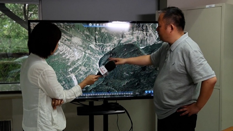
China Prepares ‘3D Image’ of Landslide-Affected Area, State-of-the-Art Technology in Search and Rescue

August 30, Kathmandu.
A 3D image of the landslide-affected area in Southwest China’s Tibet Autonomous Region has been prepared. China has released three-dimensional, or 3D, images of the landslide-hit areas in Xizang, also known as Tibet.
Chinese authorities intensified search and rescue operations at the Gyirong border port on Friday. Rescuers have accelerated the rescue campaign, racing against time to save lives.
According to the regional emergency management department, five people have died and 558 are still missing as of 3 p.m. Friday.
They went missing after a landslide that occurred on Nepal’s territory on Wednesday morning reached the Gyirong Port in Gyirong County. Among the missing, 260 have been identified as foreign nationals.
According to the National Fire and Rescue Administration, a total of 681 fire and rescue personnel and 113 vehicles had arrived in the remote mountainous border area as of 10 a.m. Friday. In addition, 6,612 pieces of rescue equipment and supplies have been sent to Gyirong Village.
In the first phase, 141 rescuers and a helicopter capable of flying at high altitudes arrived at the port on Thursday morning. Subsequently, an additional 111 rescuers from the China Search and Rescue Team arrived in Gyirong County on Thursday afternoon.
Advertisement
Fire and rescue personnel have formed three special teams for search and rescue. One team is working by using rubber boats on waterways, another by trekking through mountainous terrain, and the third by conducting aerial inspections and supplying relief materials via drones.
One team has been dispatched to the main disaster-affected area. This team is using drones and binoculars to map, inspect, and conduct targeted surveillance of the site and the formed lake.
Thirteen experts from the Shanghai Fire Research Institute under the Ministry of Emergency Management have also arrived at the scene.
China Aneng, a state-owned engineering and rescue company, deployed a 15-member team on Friday. The team is using drones, portable satellite stations, and mobile surveillance cameras to conduct on-site surveys of obstructions and nearby roads.
Its objective is to provide accurate data for the necessary efforts in managing the risks associated with the formed lake.
According to rescuers, the risk created by the accumulated debris approximately 3 kilometers upstream from the port can only be safely removed after the obstruction is resolved. (CCTV Plus)
For more: China Releases 3D Images of Landslide-Affected Area